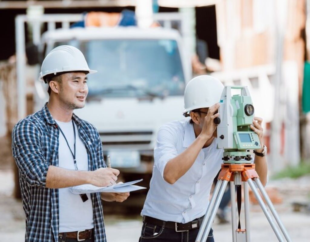
Understanding the Importance of Construction Surveys
Construction surveys are vital to the successful execution of any building project. They act as a foundational reference that informs every subsequent step in the construction process. Without accurate surveys, projects can face significant risks, leading to complications that could ultimately delay timelines and inflate budgets.
The importance of construction surveys extends beyond simple measurements; they facilitate efficient project planning and execution by providing essential data on land features, boundaries, and existing conditions. An effective survey allows project teams to visualise and understand the site, hence optimising design and construction strategies.
The Role of Construction Surveys in Project Planning
In project planning, construction surveyor provide critical insights that drive decision-making. They assist engineers and architects in determining the most suitable locations for structures, thereby enhancing the overall design process. By understanding the topography and limitations of a site, teams can innovate more efficiently and effectively.
Moreover, precise surveys delineate areas for construction, ultimately preventing conflicts with local regulations or neighbouring properties. Surveys can also help in assessing environmental impacts, which is increasingly relevant in today’s eco-conscious climate. This information is crucial for securing permits and alignments with zoning laws. Additionally, the data gathered during these surveys can be invaluable for future developments, as it creates a comprehensive record of the site’s characteristics that can be referenced for subsequent projects.
Ensuring Safety and Accuracy Through Construction Surveys
Safety is paramount in construction, and accurate surveys contribute significantly to ensuring a secure working environment. By providing clear data regarding the land and its features, surveys prevent accidents related to miscalculations or misconstructions. For example, if ground conditions are not correctly assessed, it could lead to unstable structures with potentially perilous consequences.
Furthermore, construction surveys involve thorough checks that help in maintaining high construction standards and compliance with legal requirements. Accurate data leads to fewer discrepancies during the construction phase – which not only safeguards the project but also ensures that the final outcome meets or exceeds the expected quality. Additionally, the integration of advanced technologies such as GPS and 3D laser scanning in construction surveys has revolutionised the accuracy and efficiency of data collection. These innovations allow for a more detailed analysis of the site, enabling teams to identify potential issues before they arise, thereby further enhancing safety and project reliability.
The Different Types of Construction Surveys
There are various types of construction surveys, each serving a unique purpose in the project lifecycle. Understanding these different surveys is crucial for selecting the most suitable method for a particular project. Below, we will explore the key types of construction surveys commonly employed in the industry.
Topographic Surveys: Mapping the Land
Topographic surveys are compiled to create detailed representations of the terrain and landscape’s physical features. These surveys map out natural elements such as hills, valleys, water bodies, and existing structures. They establish vertical and horizontal positions, providing a comprehensive overview of the site’s contours.
Topographic surveys are indispensable for architects and engineers, who require detailed information about the geography of the site to make informed design decisions. These surveys can be utilised not just in the planning phase but also during construction to monitor changes in the landscape. The data gathered can also be instrumental in assessing environmental impacts, allowing for more sustainable construction practices. By understanding the topography, professionals can devise strategies to minimise erosion, manage stormwater runoff, and preserve natural habitats, thereby aligning construction projects with ecological considerations.
Boundary Surveys: Defining Property Lines
Boundary surveys are carried out to determine the exact location of property lines and corners. They are vital for preventing disputes with neighbouring landowners and are often used in residential projects where clear demarcation is required. The accuracy of boundary surveys can prevent legal issues related to encroachments and ensure compliance with local regulations.
By obtaining precise data on property boundaries, developers can confidently execute their projects without the fear of overstepping their legal boundaries. Additionally, boundary surveys are critical in establishing easements and right-of-ways necessary for utilities and access roads. This aspect is particularly important in urban areas, where space is often limited and the implications of boundary disputes can be significant. Furthermore, boundary surveys can enhance property value by ensuring that all improvements are within the legal limits, thus providing peace of mind to property owners and investors alike.
Construction Staking: Translating Plans into Reality
Construction staking serves as a transitional phase where survey data is mapped out on the ground, translating project plans into physical markers. It involves placing stakes in the earth to indicate the locations of proposed structures and features, thus guiding construction crews during the building phase.
This process not only ensures that structures are placed correctly according to architectural designs but also helps in visualising the overall layout of the project. Construction staking is crucial for maintaining accuracy, which is vital for the integrity of the finished structure. Moreover, it allows for the identification of potential issues before construction begins, such as conflicts with existing utilities or natural features that may not have been apparent during the planning stages. This proactive approach can save time and resources, ultimately leading to a smoother construction process. Additionally, accurate construction staking can facilitate compliance with zoning laws and building codes, ensuring that the project adheres to all necessary regulations and standards.
The Process of Conducting a Construction Survey
Conducting a construction survey requires a systematic approach that encompasses various stages, from initial research to the final report. Each phase is critical to ensuring the accuracy and reliability of the survey data collected. Below we break down the process into manageable components.
Initial Research and Planning
Before any physical surveying can begin, thorough research and planning are essential. This phase involves reviewing existing maps, satellite imagery, and historical data regarding the site. By understanding the characteristics and history of the area, surveyors can identify any potential challenges that may arise during the survey.
During the planning phase, surveyors establish the objectives of the survey and determine the methodologies they will employ. This proactive approach is crucial for ensuring that all necessary data will be collected and that potential risks are proactively mitigated. Additionally, engaging with local authorities and stakeholders can provide valuable insights into any regulatory considerations or community concerns that may impact the survey process.

Fieldwork: Gathering Data on Site
Fieldwork is where the actual surveying takes place. Surveyors use various tools and techniques to gather data on-site, including total stations, GPS systems, and laser scanning. This step is critical as it involves obtaining measurements regarding the topography and boundaries directly from the field, providing real-time insights.
Surveyors also take into account environmental factors that may affect their measurements, such as weather conditions and topographical challenges. Adapting to these on-the-ground realities contributes to the overall accuracy of the survey results. Furthermore, the surveyors must be vigilant about safety protocols, ensuring that all personnel are equipped with the necessary protective gear and that the site is secure from potential hazards, which is particularly important in urban areas where construction activities are prevalent.
Data Analysis and Report Preparation
Once fieldwork is complete, the collected data is rigorously analysed to produce comprehensive survey reports. This analysis helps in interpreting the measurements collected, ensuring clarity and accuracy in understanding site characteristics. The findings are then compiled into reports that provide essential information for project stakeholders.
These reports are not just data-driven; they include recommendations and insights based on the survey findings. Issuing clear and understandable reports is imperative for aiding decision-making processes during project planning and execution. In addition, the integration of visual aids such as maps, graphs, and 3D models can significantly enhance the comprehensibility of the data presented, making it easier for stakeholders to grasp complex information and facilitating more informed discussions about the project’s direction and potential modifications.
The Tools and Technology Used in Construction Surveys
The landscape of construction surveying has evolved significantly over the years, with advancements in technology dramatically enhancing the precision and efficiency of the surveys. Both traditional and modern tools play essential roles in various surveying contexts.
Traditional Surveying Tools and Their Uses
Despite the rise of digital technologies, traditional surveying tools remain widely used in the industry. Instruments such as the theodolite, tape measures, and level rods offer reliable means for obtaining measurements. These tools have been foundational in shaping the principles of survey methodology.
Traditional tools often serve distinct purposes: theodolites for angles, tapes for distances, and levels for elevation. Their effectiveness stems from simplicity and reliability, making them indispensable for localised survey needs.
The Rise of Digital Surveying Technology
In contrast to traditional methods, digital surveying technologies have surged in popularity, offering unparalleled accuracy and efficiency. Techniques such as 3D laser scanning, drones, and geographic information systems (GIS) have transformed the surveying process. Situations that might require extensive manpower can now often be completed swiftly using digital means.
These technologies not only increase speed and accuracy but also improve data integration, allowing professionals to visualise projects in innovative ways. Such advancements are not merely trends; they signify a fundamental shift in the survey landscape, making projects more efficient and accessible.
Hiring a Professional Surveyor: What to Consider
When it comes to construction surveys, hiring a professional surveyor is indispensable. However, the process of selecting the right surveyor requires careful consideration of several key factors. By making informed choices, project managers can ensure a smooth surveying process that effectively supports their overall goals. Click here to get how surveying companies assist in construction planning.
Qualifications and Experience: Choosing the Right Surveyor
The qualifications and experience of a surveyor should be a top consideration when hiring a professional. Surveyors should have appropriate educational backgrounds, certifications, and licenses required for their profession. Additionally, experience with specific types of surveys relevant to the project is crucial; for example, a surveyor well-versed in boundary surveys would be less suited for topographic surveys without relevant experience.
Additionally, evaluating previous work and seeking recommendations can provide insight into the surveyor’s expertise and reliability. A proven track record is often an indicator of quality service, ensuring that your project is in capable hands.

The Cost of Hiring a Professional Surveyor
The cost associated with hiring a professional surveyor is a significant factor that warrants consideration. Surveying fees can vary widely based on project complexity, location, and the surveyor’s level of expertise. It is advisable to obtain quotes from multiple surveyors to gauge a reasonable price range while considering the value of experience and quality of service.
Ultimately, while cost is important, it should not be the sole deciding factor. Investing in a qualified, experienced surveyor can save money in the long run by preventing costly errors and project delays. This prioritisation of quality over cost can yield far better results in the end.

